Publication · HCII 2025
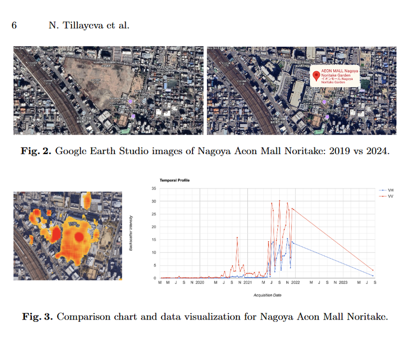
Discovering Emerging Urban Hotspots
Satellite imagery + human-mobility data to inform sustainable urban design. Presented at HCI International, Sweden.
Read paper (DOI) ↗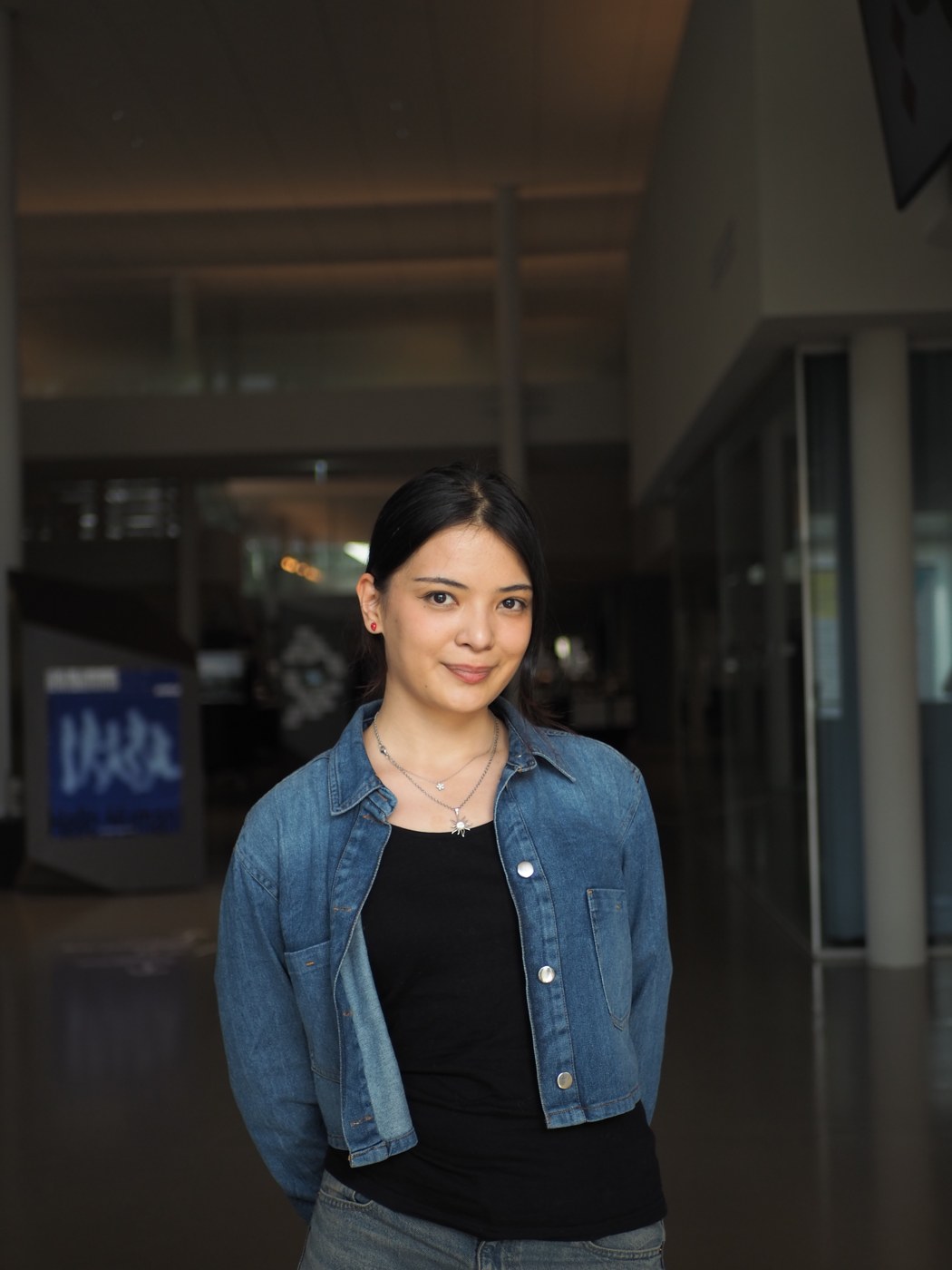
Hi, I'm NODIRA
I'm a graduate researcher specializing in remote sensing, GeoAI, and ubiquitous computing. Currently pursuing an M.E. in Electrical Engineering at Nagoya University, I build geospatial and computer-vision systems that turn satellite & sensor data into tools for sustainable development.
Selected publications in geospatial AI, human mobility & remote sensing.
Satellite imagery + human-mobility data to inform sustainable urban design. Presented at HCI International, Sweden.
Read paper (DOI) ↗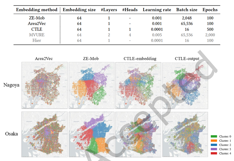
Comparing ZE-Mob, Area2Vec & CTLE embeddings to cluster urban regions across Nagoya & Osaka.
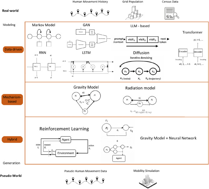
A framework of data-driven, mechanism-based & hybrid approaches for simulating human mobility and disease spread.
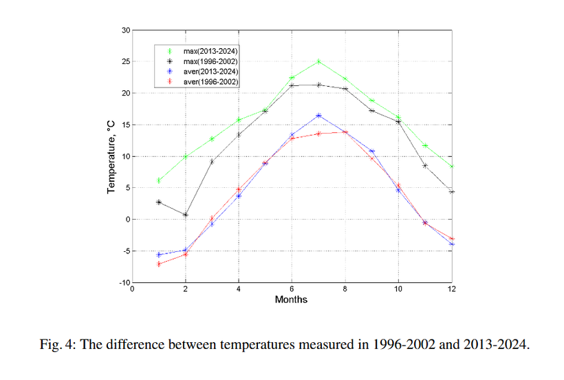
Long-term site climate — comparing temperature records from 1996–2002 vs 2013–2024.
Center for Space Monitoring & Geoinformation Technologies · AI & Software Dept.
Built a seismic monitoring system (ArcGIS JS SDK) and co-developed a Mask-RCNN parcel-detection pipeline on Sentinel-2 imagery.
Ulugh Beg Astronomical Institute
Correlated Copernicus ERA5 reanalysis with ground & telescope observations in Python, reaching 96% accuracy.
Technovation Challenge · UniSat
Coached teams of high-school girls in app development — UX, Java/Python coding & market research.
M.E. in Electrical Engineering, Graduate School of Automotive Engineering
UCLab member · Coordinator, Google Developer Club on Campus
B.E. in Software Engineering
Dean's List Award · Capstone: autonomous driving with ROS TurtleBot3
IELTS 8.0 · Global Ambassador, Huawei Seeds for the Future (2023 — Present).
On water management using space tech. Presented 3D dam visualizations for real-time water monitoring.
Moderated a regional session on data scarcity & climate action with remote sensing.
Top 5 of 2,100+ (0.2%) — presented at the World Summit in Silicon Valley.
Assembled a 1U nanosatellite with 8 environmental sensors; analyzed PM2.5/PM10 data.
Interviews, features & mentions.